LAND-DAR

LAND-DAR
Airtext is proud to announce a new product that will improve landings and provide accurate above the ground callouts to assist in the landing process.
Call/Request
Request a Quote
Land-DAR
![]()
Airtext is proud to announce a new product that will improve landings and provide accurate above the ground callouts to assist in the landing process. Landings account for more than 40% of accidents in aviation. A stabilized, consistent and accurate approach can minimize landing problems. Traditionally the main criteria for round-out and flaring an airplane is based on depth perception. Truly, landing is in essence an art based on visual cues processed by the pilot. Land-DAR can change this art of landing into more of a science with specific information as to height above the runway.
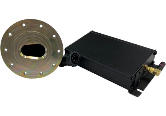
Land-DAR altitude information comes from a single, light-weight, digital device using a Laser. LiDAR sensors are used in drones, automobiles, robotics and many other applications. The name LiDAR is an abbreviation for Light Detection and Ranging. Land-DAR is Distance and Ranging information to be used in the Landing phase of flight. Older Radar Altimeters in airplanes have traditionally been used to make a single callout at a preset altitude. Larger modern airplanes, business, commercial and military aircraft traditionally use Ground Proximity Warning Systems (GPWS) that will call out a prescribed list of altitudes on approach. Land-DAR can make callouts from up to 500 feet down to 5 feet above the ground.
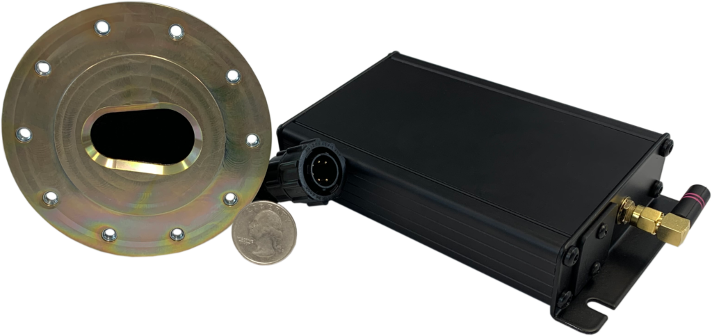
*Quarter shown for scale
Land-DAR Configuration
Previous
Next
The land-Dar device is configured via a free application available on iOS and Android. Users can configure callout altitudes, output volume, zero offset and much more. Settings are sent from your phone or tablet to the Land-DAR and are saved on the device. As with many of our devices, Land-DAR utilizes Bluetooth low energy technology allowing you to connect to the unit without a painful pairing process.
"You're only as good as your last landing!"
David Grey
President and CEO, Send Solutions, LLC
From Peripheral Vision to Digital Data
When peripheral vision is the driving force there are many aspects to landing that change the sight picture for the pilot. You have probably experienced the depth perception differences between landing on a wide or a narrow runway, or landing at night versus day, or flying a large airplane versus a smaller airplane. It is also known that depth perception decreases with age. Older pilots have a reduction in processing visual cues. Great News! Land-DAR gives you precise altitude information, the laser is measuring distance up to 100 times per second. Land-DAR is not susceptible to the radio interference from the 5G cellular network that has been found to be an issue worldwide.
Certification
Land-DAR is composed of two very small and lightweight components that have been certified by the FAA under NORSEE Part 23 aircraft approval. NORSEE is an abbreviation for Non-Required Safety Enhancing Equipment. The components are as follows, a laser sensor with mounting bracket that can be mounted in pressurized or non-pressurized compartments, and an audio interface module that connects to the aircraft audio panel. Installation is accomplished by an authorized Airtext Avionics facility that is also an FAA Repair Station. Total system weight is 14 ounces and there is minimum wiring between the sensor, the interface module and the audio panel. Installation is completed using a free Bluetooth App with either Apple or Android phones. Mounting offset, setting volume, and assigning callout altitudes are done inside the app and then set and no app usage is necessary for the pilot.